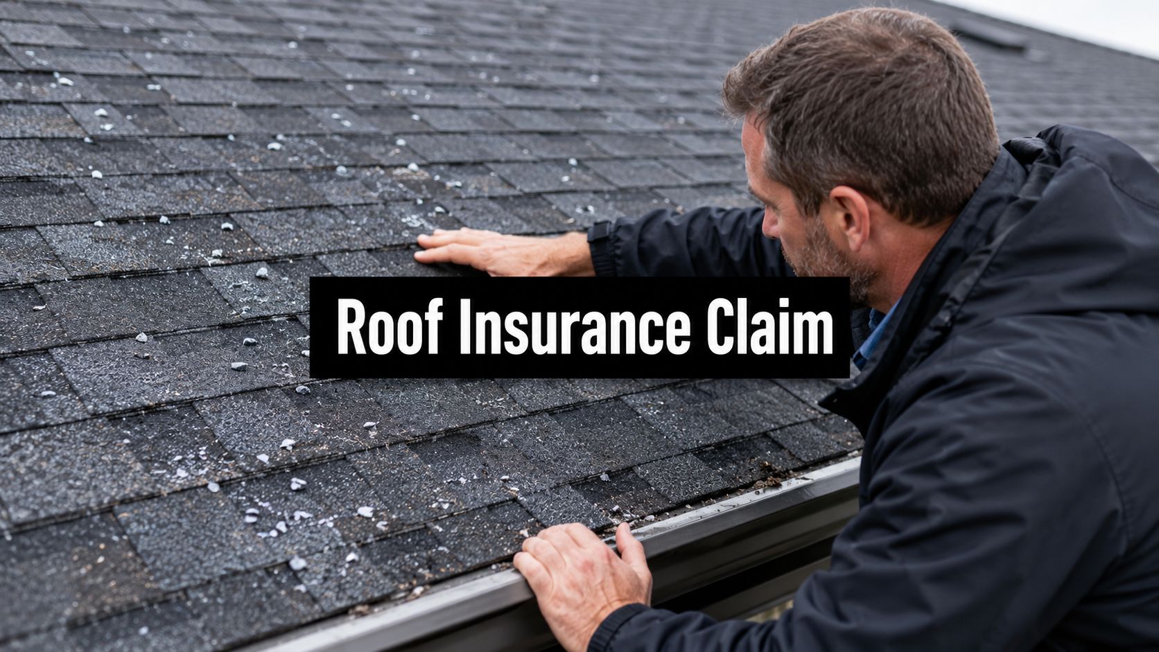
You walk outside after a windstorm, look up, and know something's wrong. A few shingles are out of place. There's debris in the gutter. Maybe there's already a water stain spreading across a bedroom ceiling. The insurance company wants documentation, the roofing contractor wants access, and you're stuck wondering how to prove what happened before the damage gets worse.
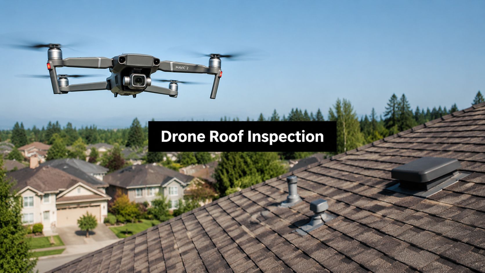
That's where a drone roof inspection changes the entire conversation.
Instead of sending someone onto a slick, damaged roof and hoping they catch everything, a properly run drone inspection creates a detailed visual record you can use. It gives you organized evidence, measurable damage, and a cleaner path into the claims process. That matters because insurance disputes often start with poor documentation, not just policy language.
This isn't some niche gadget trend. The drone inspection market is projected to grow from $11.6 billion in 2022 to $23 billion by 2027, and PricewaterhouseCoopers estimates drones could save the insurance industry up to $6.8 billion annually by streamlining assessments and reducing overhead, according to this drone inspection market projection and insurance savings estimate. Insurers already understand the value of fast, precise data. Property owners should use that same advantage.
Your Roof Is Damaged Now What
The first mistake most property owners make is waiting too long to document the roof.
A storm passes. You call your carrier. An adjuster visit gets scheduled. In the meantime, wind lifts more material, rain gets under the system, and what started as roof damage starts turning into interior damage. Then the claim gets framed as “limited impact” because the first inspection missed the full scope.
That's avoidable.
A drone inspection gives you a way to document the condition of the roof early, from a safe position, without delaying while someone arranges ladders or decides whether the slope is walkable. If your building has metal roofing and you're trying to understand what visible punctures or openings might mean before repairs begin, this guide on how to repair a hole in a metal roof is a useful reference for what contractors look for once damage is confirmed.
Start with documentation, not assumptions
If you suspect roof damage, don't start by debating whether it's “bad enough.” Start by preserving evidence.
Use a practical property checklist, take ground-level photos, and track when the storm occurred. A solid starting point is this property inspection checklist so you don't miss items that later become part of the claim file.
Practical rule: The roof doesn't need to be falling in for the claim to be serious. It needs to be documented before conditions change.
What stressed owners usually need most
Those in this position don't need jargon. They need three things:
- Clear proof: Images and measurements that show where damage exists.
- A safer process: No unnecessary foot traffic on a compromised roof.
- A claim-ready record: Something more useful than a few cellphone photos.
A good drone inspection does all three. It shifts your position from “I think the roof was damaged” to “Here is the recorded condition, section by section.” That's a stronger place to be when the carrier starts narrowing the claim.
What Is a Drone Roof Inspection
A drone roof inspection is not just aerial photography. It's a structured data collection process designed to capture the roof surface in enough detail to support evaluation, measurement, and reporting.
The best operators don't merely fly over the building and hand you a folder full of random images. They capture overlapping imagery, follow a planned path, and produce inspection outputs that can be reviewed systematically. Think of it as building a digital version of the roof that others can inspect without climbing onto it.
What the inspection actually creates
A professional drone inspection may produce several useful records:
- High-resolution roof imagery: Close visual documentation of slopes, ridges, valleys, penetrations, and edge conditions.
- Orthomosaic map: A stitched, top-down image that works like a precise map of the roof surface.
- 3D model: A digital structure that helps with measurements, slope review, and overall condition assessment.
- Thermal imagery when needed: A separate visual layer that can help identify moisture-related anomalies.
If you manage a larger building or want a broader operational perspective, this practical roof inspection approach is worth reading because it reflects how inspection strategy changes once roof complexity increases.
Drone vs Traditional Roof Inspection
| Metric | Drone Inspection | Traditional Manual Inspection |
|---|---|---|
| Safety | Inspector stays off the roof during primary data capture | Inspector may need to climb and walk the roof |
| Speed | Detailed inspection can be completed quickly with planned flight capture | Slower due to ladder setup, access limits, and manual movement |
| Data quality | Creates organized visual records, mapping, and reviewable files | Often depends on notes, handheld photos, and what the inspector can safely reach |
| Claim support | Easier to share with adjusters, contractors, and consultants | Harder to standardize and review later |
| Roof access | Works well on steep, high, or awkward roofs | May be limited by pitch, condition, or safety concerns |
Why this matters in a claims setting
Insurance disputes usually turn on evidence quality. If the roof was only partially observed, the scope may be partially written. If the record is fragmented, the estimate often is too.
That's why I prefer a drone-based inspection file over a verbal opinion every time. A visual record is harder to ignore, easier to revisit, and far more useful when you need to compare what your contractor saw against what the carrier's adjuster allowed. For property owners who want to understand how professionals inspect structures more broadly, this overview of a building inspection job gives useful context.
Key Benefits for Your Property Damage Claim
A carrier adjuster writes what they can defend. If your roof file is thin, incomplete, or limited to a few handheld photos, the estimate usually follows the same pattern. Drone inspection changes that by giving your side a clear visual record we can use to challenge omissions, low scope, and weak causation arguments.
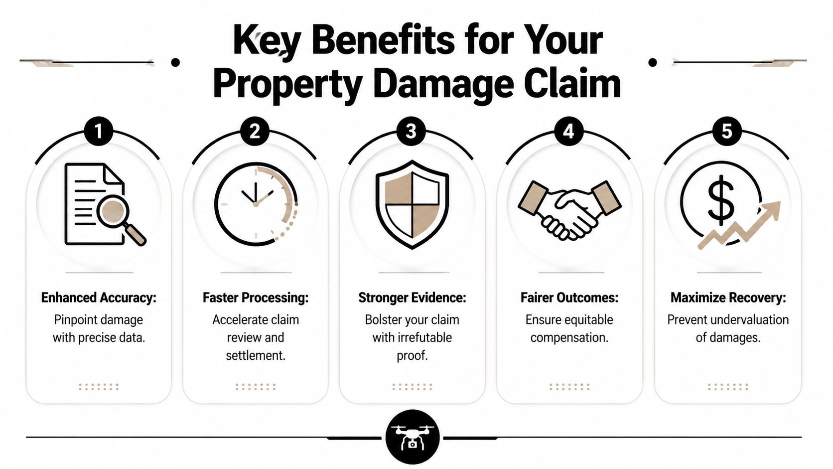
Faster evidence, less delay
Time matters after a loss. Rain continues. Temporary repairs happen. Stains spread. Shingles crease further in wind. The longer a roof goes undocumented, the easier it becomes for the insurer to question what was storm-related and what happened later.
Drone capture helps close that window fast. A roof that would be slow, risky, or partially inaccessible by ladder can often be documented in one visit with a complete set of reviewable images. The point is not speed for its own sake. The point is preserving evidence before the condition changes and before the carrier narrows the claim around an incomplete first look.
Better claim posture
Good drone files improve a claim in ways property owners feel immediately and insurers notice quickly.
- They document areas the carrier may understate or miss: ridges, valleys, flashing lines, vents, transitions, soft spots, and steep sections that are easy to skip in a rushed field inspection.
- They create a consistent record for everyone reviewing the loss: your contractor, roofer, engineer, and public adjuster can all work from the same image set instead of conflicting descriptions.
- They support scope disputes with specifics: we can point to exact slopes, exact damage patterns, and exact roof components instead of arguing in general terms.
- They preserve the condition early: that matters if emergency tarping, debris removal, or more weather alters the roof after the first inspection.
- They reduce avoidable safety exposure: the operator gets the initial documentation without sending someone onto a wet, brittle, or unstable roof.
The strongest roof claim is usually the one with the best file.
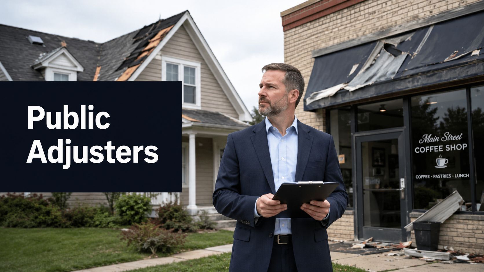
That is why drone inspection fits so well into public adjusting. We are not collecting pretty footage. We are building evidence that holds up when the carrier says the damage was minor, isolated, pre-existing, or limited to repair instead of replacement.
Lower field cost can mean earlier, better documentation
Cost matters, but a primary advantage is timing. Drone roof inspections are often priced competitively with hands-on inspections, and in many cases they cost less because the operator can capture the roof efficiently without the same access burdens and safety constraints. If you want a market snapshot, this overview from Thumbtack on roof inspection pricing shows typical inspection cost ranges homeowners see.
What I care about more is what that means for your claim. When documentation is easier to schedule and more affordable to obtain, property owners are more likely to get the roof recorded early instead of waiting until the insurer has already framed the loss too narrowly.
If you are deciding whether to bring in professional claim help, these benefits of hiring a public adjuster for property damage claims explain why evidence quality often drives the result. A strong adjuster can only argue from the file in front of them. Drone data gives us a much stronger file.
The Inspection Workflow and Deliverables
The inspection should produce claim evidence, not just attractive aerial footage. If the operator cannot explain how the images, measurements, and reports will support a coverage argument, you are paying for pictures instead of proof.
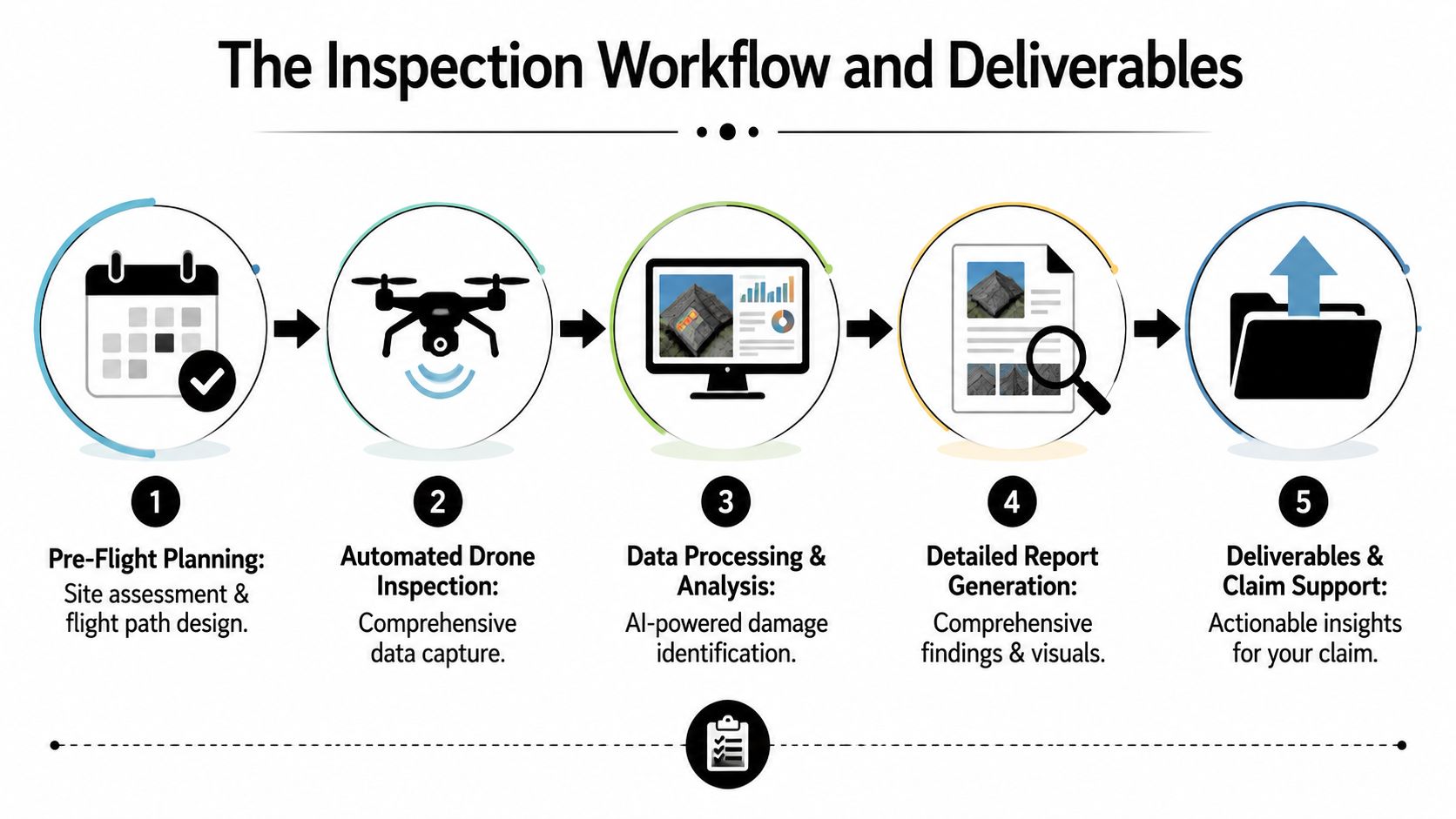
Before the drone leaves the ground
A proper inspection starts before takeoff. The operator reviews roof layout, slope changes, access constraints, trees, utility lines, nearby structures, and the safest launch area. For claim work, they also need to know what loss they are documenting so the flight captures the areas an insurer is most likely to question.
Image quality matters, but planning matters just as much. The crew should capture high-resolution stills, stable video if needed, and enough overlapping images to build an accurate roof map and measurement set. If they are vague about flight planning or deliverables, expect a weak file.
During the flight
The flight itself is usually efficient. The drone follows a repeatable path and records each roof plane from multiple angles so the final set covers ridges, valleys, flashing, penetrations, transitions, edges, and any visible impact areas.
That consistency matters in a claim.
A carrier adjuster looking for a reason to limit payment will often argue that damage was isolated, scattered, or impossible to verify across the full slope. A disciplined flight pattern helps shut that down because the roof was documented methodically, not selectively.
What you should receive afterward
The deliverables should be organized for claim use, not dumped into a folder with no explanation. Ask for these items:
- Orthomosaic image: a single corrected overhead roof image assembled from many photos. This helps show the full damage pattern across each slope.
- 3D model: a measurable roof model that helps confirm layout, pitch changes, and area calculations.
- Annotated photo set: labeled close-up images that identify the specific conditions being cited, such as lifted shingles, fractured tabs, damaged vents, failed flashing, or impact marks.
- Damage report: a written summary that ties the visuals to observed conditions in plain language a desk adjuster, engineer, or appraiser can follow.
- Measurement outputs: roof area, facet dimensions, and other takeoff data used to test the insurer's estimate for missing or understated scope.
Field advice: If the vendor cannot organize the file so a stranger can understand the roof condition in minutes, the insurer will use that confusion against you.
Where thermal imaging fits
Thermal imaging can help on the right loss, especially where moisture intrusion is in dispute. It may show temperature differences that support closer review of wet insulation, trapped moisture, or water migration below the visible surface.
Use it correctly. Thermal images do not prove every moisture claim by themselves, and they are not needed on every roof. But in the right case, they give your public adjuster another way to challenge the carrier's favorite position that the problem was minor, cosmetic, or limited to what can be seen from the top layer.
The best workflow ends with a file your adjuster can use. That means clear visuals, measurements that can be checked, and a report built to support scope, cause, and value. That is how drone inspection strengthens a claim.
Oregon and Washington Drone Regulations and Safety
A storm hits, the roof is compromised, and the carrier is already looking for reasons to narrow the loss. The last thing you need is a drone operator who creates another problem. In Oregon and Washington, the inspection has to be lawful, controlled, and documented the right way from the first flight.
Start with the operator. If the drone is being used for paid inspection work, the pilot should hold FAA Part 107 certification. Ask for proof. Do not accept vague answers, a social media page, or “we do this all the time.” A claim file built on casually gathered images is easier for an insurer to question, discount, or ignore.
State and local conditions matter too. Western Washington and Oregon properties often have tall trees, tight lot lines, power lines, wet surfaces, gusty weather, and neighborhoods that leave little room for sloppy takeoffs or drifting flight paths. A qualified crew plans for those conditions before they ever leave the ground.
A professional operator should handle four things without being prompted:
- Airspace checks: confirming whether the property is near controlled or restricted airspace and securing any needed authorization before the flight
- Safe setup: choosing a launch and landing area clear of people, cars, pets, wires, and roof access activity
- Weather judgment: postponing the mission if wind, rain, or visibility will reduce image quality or create risk
- Privacy control: keeping the mission centered on the insured building and avoiding unnecessary capture of neighboring yards, windows, or roofs
Privacy concerns are legitimate. Good crews keep the inspection tight, explain what they are photographing, and tell you how the files will be stored and shared. That protects you and prevents side disputes that have nothing to do with your loss.
Safety also affects claim strength. Insurers look for excuses to challenge evidence. If the flight was careless, poorly documented, or handled by someone who cannot explain basic compliance, the carrier has an opening. If the operator is qualified and the mission is disciplined, your public adjuster has cleaner evidence to use when disputing scope, causation, and price.
That is the standard you want. For a broader view of what competent inspection support should look like, review this guide to roof inspection contractors for insurance-related property damage.
One more point. The drone pilot captures the evidence. Your public adjuster turns that evidence into a claim position the carrier has to answer. That distinction matters. A lawful, safe flight protects the file. A well-built claim uses that file to stop the insurer from brushing off roof damage as minor, isolated, or cosmetic.
Hiring Checklist How to Choose a Drone Service Provider
The wrong drone vendor can weaken your claim.
I see this mistake often. A property owner hires the first pilot who can get a drone in the air, then ends up with a folder of random photos, no roof diagram, no damage mapping, and no one who can explain why the images matter. Insurers take advantage of gaps like that. If the file is sloppy, the carrier has room to minimize scope, question causation, or ignore affected areas altogether.
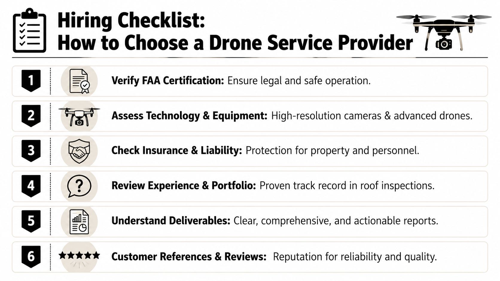
Use this checklist before you hire
Choose a provider who can produce evidence your public adjuster can use.
- Verify FAA credentials: Ask for Part 107 proof and the pilot's full legal name. If they hesitate, hire someone else.
- Review sample deliverables: Ask to see a finished report, not a highlight reel. You want labeled images, roof-wide views, close-ups, and organized files.
- Confirm the scope of capture: Make sure they document all slopes, penetrations, gutters, flashings, vents, skylights, and other roof components tied to the loss.
- Ask about thermal work carefully: If moisture intrusion is part of the claim, confirm whether thermal imaging is offered and who interprets it.
- Confirm insurance coverage: The provider should carry liability coverage and be willing to show proof.
- Ask who explains the findings: A pilot may gather images. Someone with claim experience should connect those images to damage, scope, and repair needs.
- Clarify turnaround and file access: Get a clear answer on delivery time, file format, and how you will receive the full inspection record.
If you are comparing field inspectors, roofers, and drone vendors, this guide to roof inspection contractors for insurance-related property damage will help you sort out who is prepared for claim work.
Ask sharper questions
Skip broad questions. Ask questions that expose whether the provider understands insurance documentation.
What exactly will I receive after the flight?
“Photos” is not enough. Ask whether you will receive annotated images, a roof layout, a findings summary, and raw files if needed.How do you document damage so it can be used in a claim?
Listen for a clear process. They should be able to explain image labeling, location references, and how they distinguish storm damage from wear or old repairs.Who reviews the file before it is sent out?
Quality control matters. A rushed upload full of unlabeled images creates more problems than it solves.Have you worked with public adjusters or insurance disputes before?
That experience matters because the goal is not just to fly the roof. The goal is to build a record the carrier has to answer.How do you protect privacy while still documenting the loss?
A disciplined provider should explain how they keep the mission focused on your building and your claim.
Use price to screen providers, not to choose one
Do not hire on price alone. The cheapest option often gives you the weakest file, and that usually costs more once the insurer starts pushing back.
Ask what is included. One quote may cover a basic photo set. Another may include detailed organization, moisture-related imaging, annotated findings, and deliverables your adjuster can use to challenge an under-scoped estimate. The better value is the provider who helps document the full loss clearly enough to support repair pricing and scope. That is how owners maximize your storm damage insurance payout.
A drone inspection is not a marketing extra. It is claim evidence. Hire the provider who treats it that way.
How We Turn Drone Data Into a Stronger Claim
A drone report by itself doesn't win a claim. Evidence only matters if someone knows how to use it.
That's where policyholders often get stuck. They have aerial images, maybe a roof report, maybe thermal findings, but the carrier still writes a narrow estimate or insists the damage is minor. The issue usually isn't the data. It's the interpretation, scope building, and negotiation that follow.
What strong claim advocacy does with the file
A good public adjuster uses drone data to do more than attach photos to an email.
They use it to:
- Build scope: Identify every affected roof section, accessory, and related component.
- Compare estimates: Measure what the carrier included against what the evidence shows.
- Support causation arguments: Tie visible damage patterns to the reported event.
- Push back on underpayment: Challenge partial allowances when the documentation shows broader impact.
At this juncture, many low offers start to unravel. Once precise imagery, mapped damage, and organized deliverables are tied to the estimate, it becomes much harder for the insurer to dismiss affected areas as isolated or insignificant.
A common claim pattern
The usual pattern goes like this. The carrier inspects quickly, allows a limited repair, and frames the roof as mostly serviceable. Then a more complete drone review shows repeated impacts or broader wind-related disturbance across multiple slopes. The conversation changes from patching a few visible spots to addressing the actual extent of loss.
If you're trying to understand the broader strategy behind documenting storm losses well and negotiating from strength, this guide on how to maximize your storm damage insurance payout is a useful companion read.
Clean documentation changes negotiations. Carriers debate opinions all day. They have a harder time debating organized evidence tied directly to the scope of loss.
When a claim moves into a valuation dispute, policyholders may also need formal help beyond the initial adjustment phase. That's where insurance appraisal services can become important, especially when both sides have reached very different numbers.
If your roof was damaged and you're tired of vague answers, talk to NW Claims Management. We help Oregon and Washington property owners turn inspection evidence into a documented, properly valued insurance claim, and we do it with the calm, direct advocacy policyholders need after a loss.